The Hakuba region will be experiencing very heavy snow, especially early this morning, totals may reach up to 45cm in some areas! With all this snow and the gust winds this morning please take proper avalanche precautions, but also enjoy the powder day!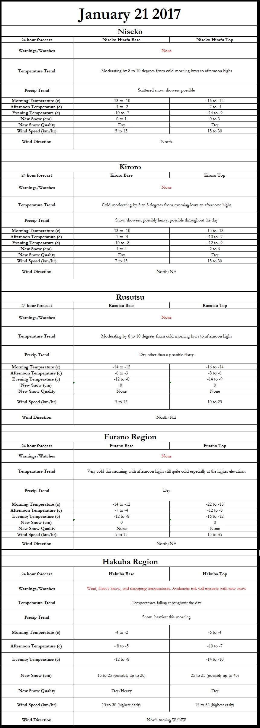
0 Comments
Hi everyone, here is the forecast graphic for today 1/18/2017. Stay tuned for a longer range forecast which will be issued in the sometime between 9am and noon of the 18th. There is the potential of a storm tonight (1/18) into tomorrow morning (1/19). That should drop some new powder that you skiers and snowboarders will absolutely love. 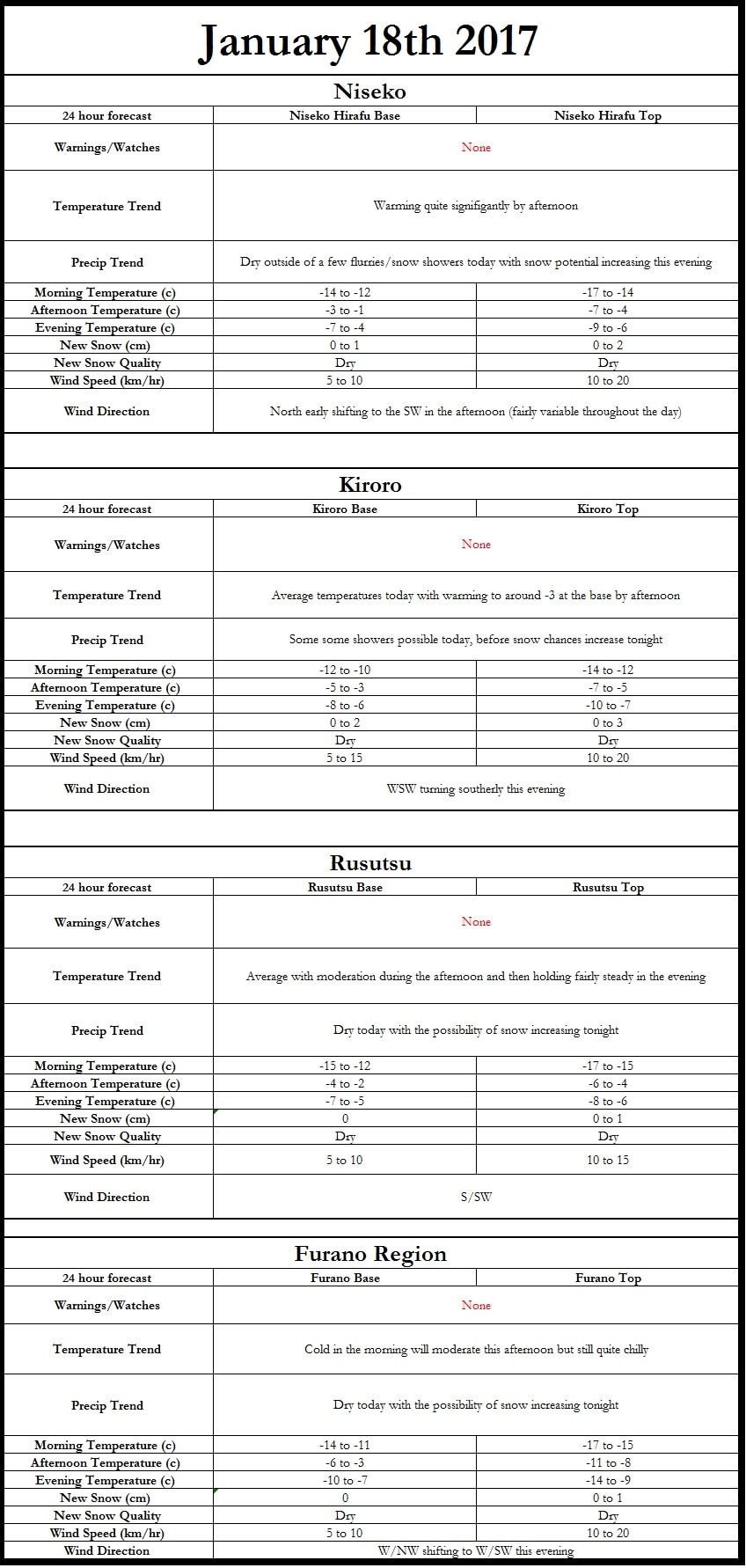 Heavy snow is now making its way onshore from the NW covering Kiroro and moving into Niseko. Road conditions and visibility are rapidly deteriorating. Please use caution. Below is a radar screen shot from 9:50am (courtesy of JMA) and a traffic camera at 9:25am (courtesy of hbc.co.jp), west of Akaigawa.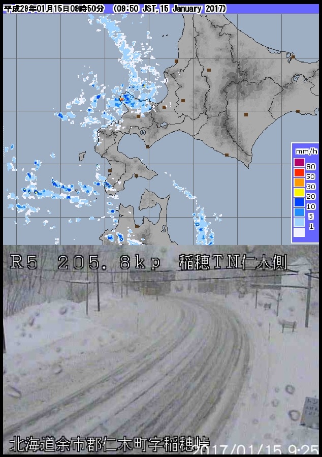 A low pressure system is spinning off the SE coast of Hokkaido currently, bringing with it snow potentially quite heavy. Down to the south towards Mori and Onuma they have picked up in excess of 20cm with much of it falling it this evening. The high resolution models are putting out some pretty impressive numbers and while I think it is overdoing the totals, I would not be surprised to see some decent totals. I will have a full forecast in the morning, but I will leave you with this pretty crazy snowfall map from our in-house high resolution model (yes it is saying +40cm). 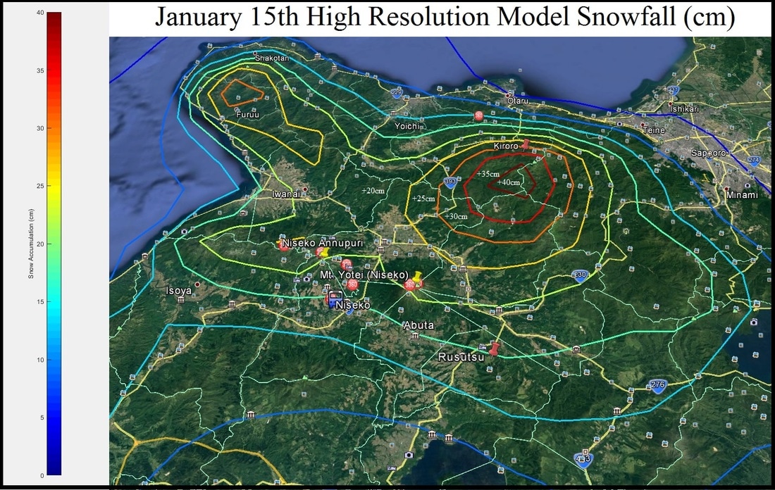 |
Author
Archives
March 2017
Categories |

 RSS Feed
|
|
Home - Trips - Cat Skiing - Ski Japan - About - Employment - Contact Us
Terms and Conditions - Privacy Policy - Specified Commercial Transaction Act Compliance - Japow Reality Check
Terms and Conditions - Privacy Policy - Specified Commercial Transaction Act Compliance - Japow Reality Check
Japan Ski Tours is an ANTA certified and licensed Japanese travel agency, registered in Tokyo, Japan
Travel Agency License No. 2-6983
Travel Agency License No. 2-6983
Japan Ski Tours, Japan Guides Group Copyright 2019 - 株式会社