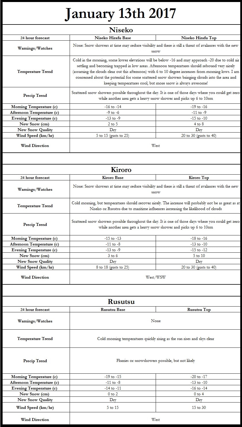
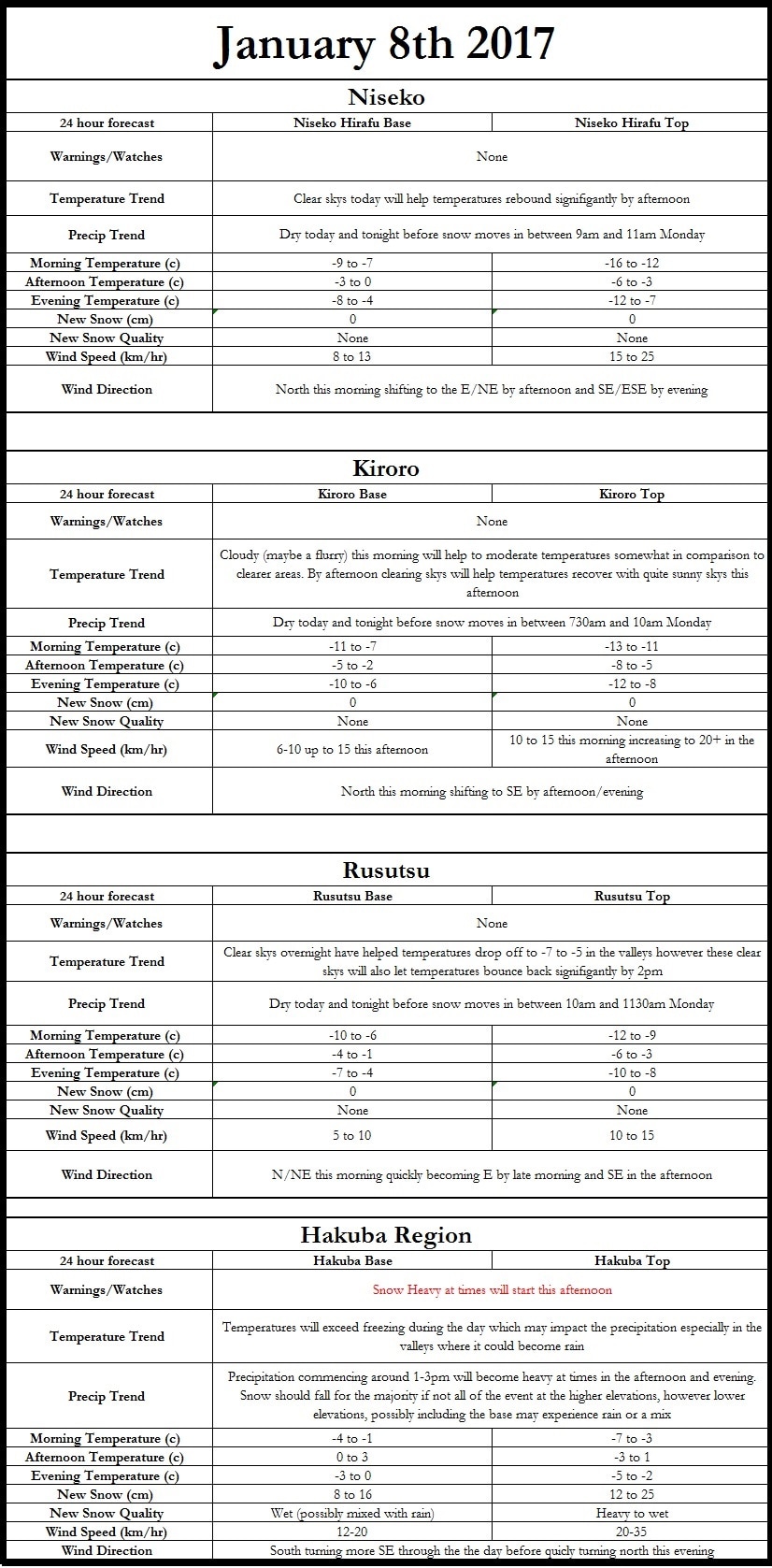
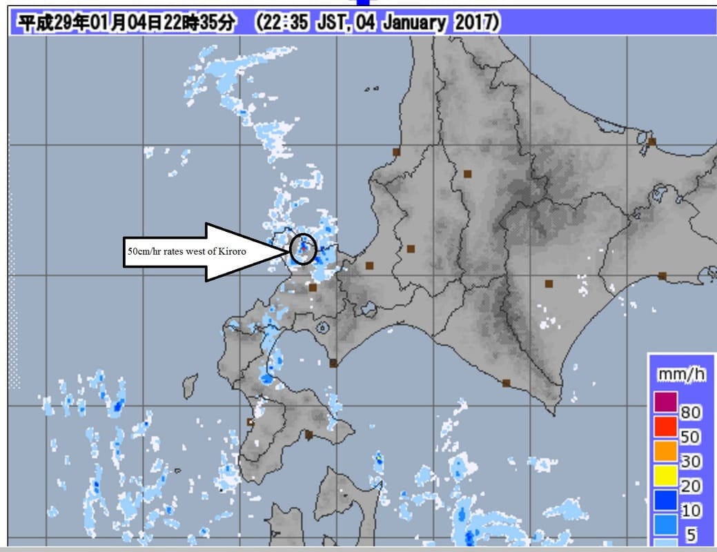
Hi all, Below is the high resolution model output for new snowfall from midnight January 12th to 9pm January 12th. This is only a model output not a forecast. Please see the forecast graphic below the snowfall graphic for a forecast. 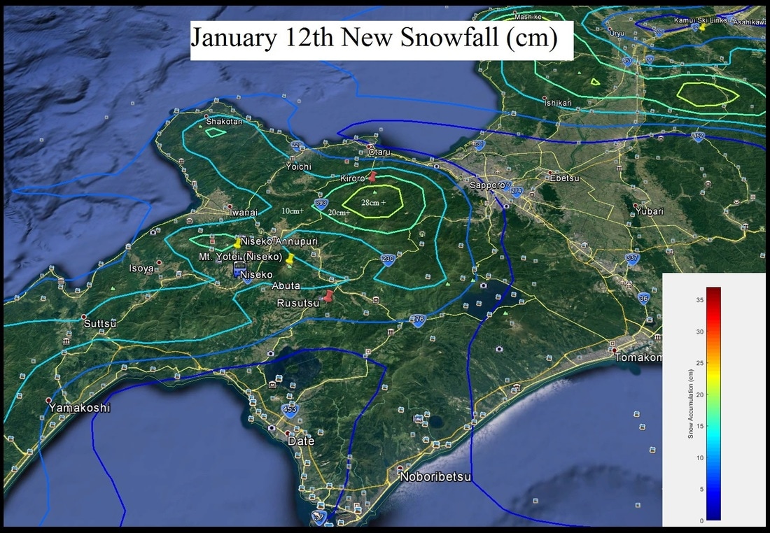 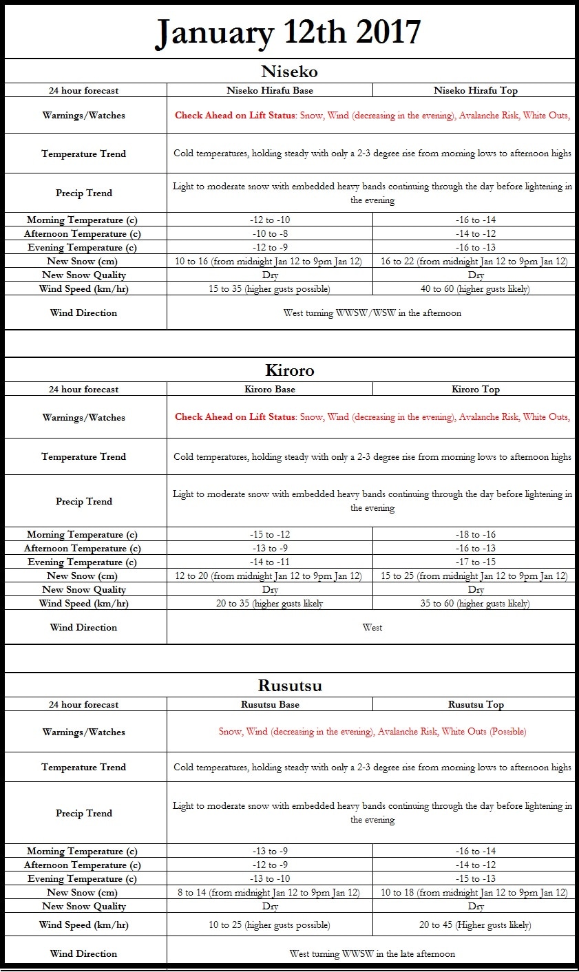 If you enjoy snow, as I think all of us reading this forecast do, today is the day for you. Well to be honest the next couple days should be quite snowy, making those across SW Hokkaido quite happy. However, I am concerned about the winds especially today across the higher elevations. Currently, there are advisories out for heavy snow, winds, and the possibility of avalanches. Temperatures at midnight are already well below zero (Makkari reporting -10.4) with colder temperatures in the mountains and cold air drainage regions. I expect temperatures to drop further, however the clouds and falling snow should help moderate the decrease to some extent resulting in morning lows of -15 to -8 across the lower regions while mountain tops will drop into the -22 to -13 range. 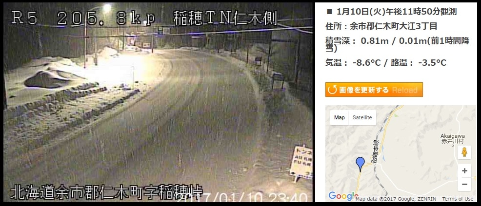 Check out this image of the snow falling at midnight! This camera is located west of Akaigawa on Japan National Route 5 260m above sea level! (Courtesy of http://www.hbc.co.jp/) 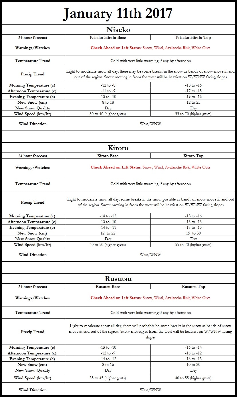 The high resolution model data is still having issues, but hopefully it will come in today (fingers crossed). I am looking at very strong winds tomorrow with data showing 50 to 60 km/hr across many of the locations above 1400m and the possibility of 70+km/hr winds on particularly high exposed slopes. There will likely be higher gusts than this. Make sure to check if lifts are open prior to heading out. 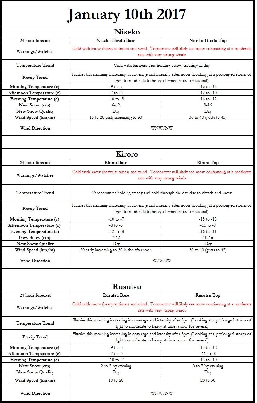 There are some issues currently with the data for our high resolution model, but below is a graphic depicting what I am seeing for today. This week should really pound all of the major ski areas in Japan however winds should also be quite strong at times, possibly reaching 70km/hr across the higher peaks of Hokkaido. I don't expect much snow today (possibly up to 12cm by evening at highest peaks), but today will be the start of a prolonged period of on and off light to moderate snow. I want to have a look at the high resolution models before making a final forecast on it, but I would be excited for fresh powder, which appears to be mostly dry at the moment. The winds as I mentioned may be an issue the middle of this week, with possible lift closures at some locations.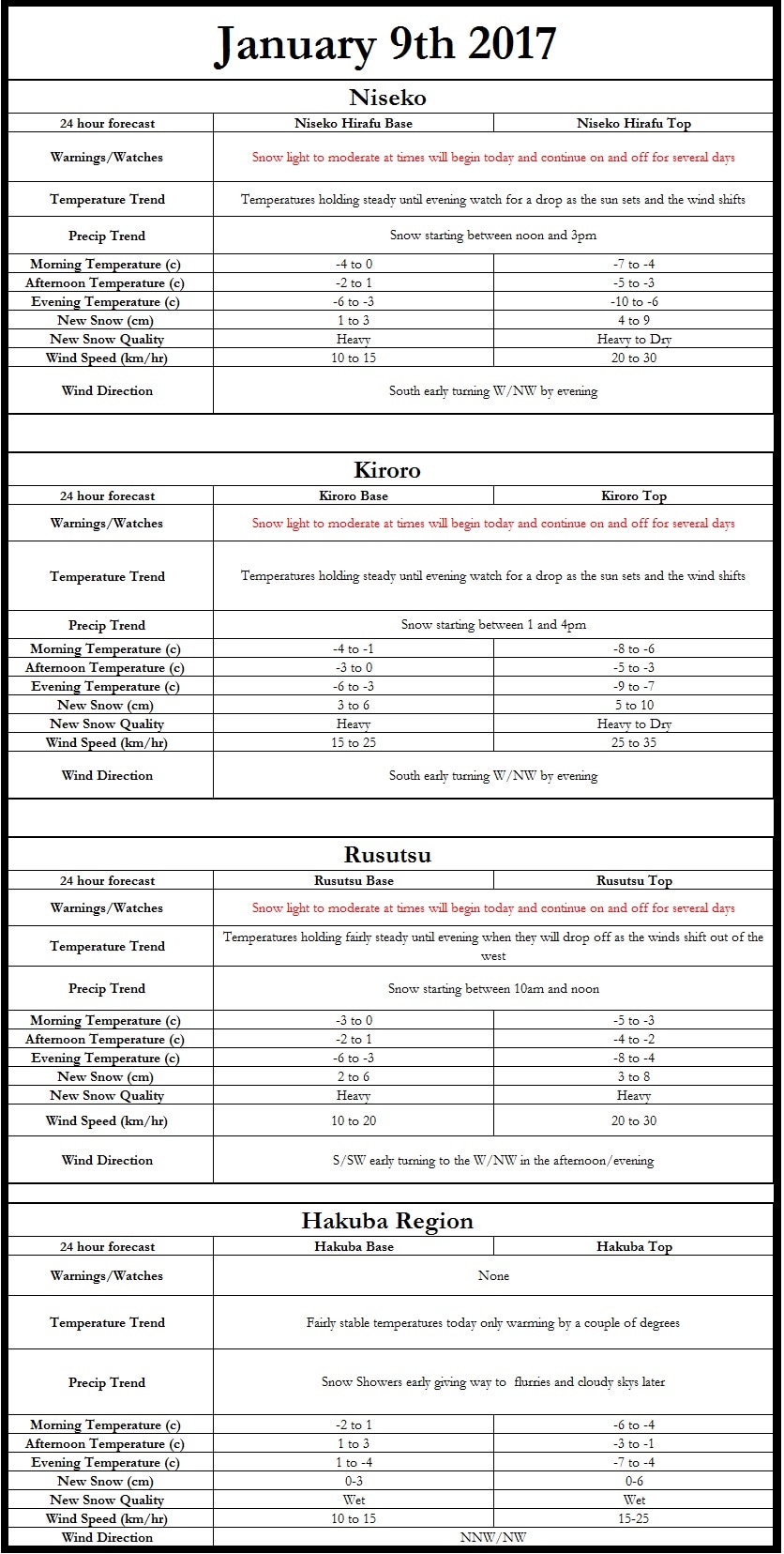 Hi all! As it is finally the weekend here in the United States I have more time to really delve into the forecast so let’s take a look at both the short and long range forecast. Also any reports, especially temperature and wind speeds, you experience at the base and top of the mountains would be much appreciated. When adjusting models and making forecasts these come in very handy. |
Author
Archives
March 2017
Categories |
 RSS Feed
|
|
Home - Trips - Cat Skiing - Ski Japan - About - Employment - Contact Us
Terms and Conditions - Privacy Policy - Specified Commercial Transaction Act Compliance - Japow Reality Check
Terms and Conditions - Privacy Policy - Specified Commercial Transaction Act Compliance - Japow Reality Check
Japan Ski Tours is an ANTA certified and licensed Japanese travel agency, registered in Tokyo, Japan
Travel Agency License No. 2-6983
Travel Agency License No. 2-6983
Japan Ski Tours, Japan Guides Group Copyright 2019 - 株式会社