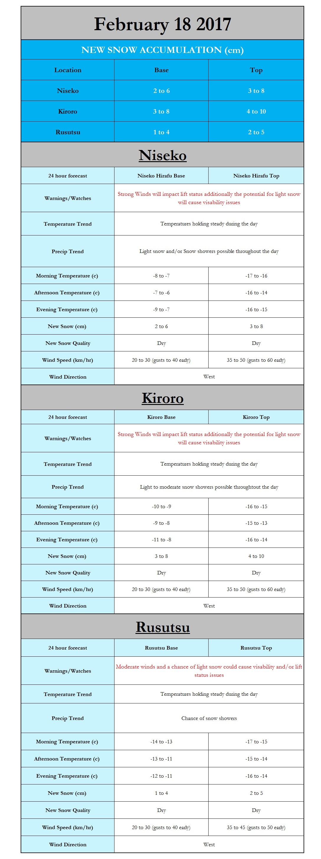
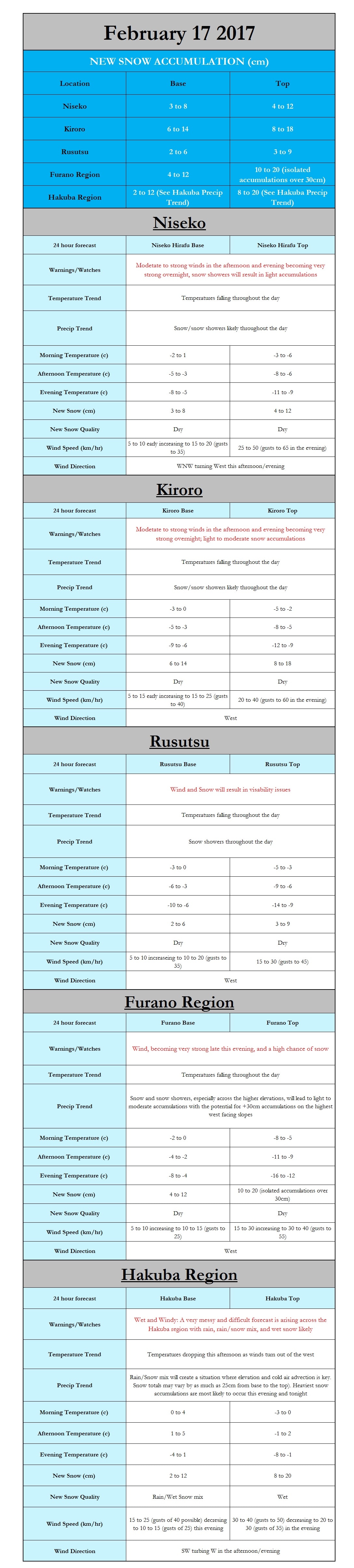
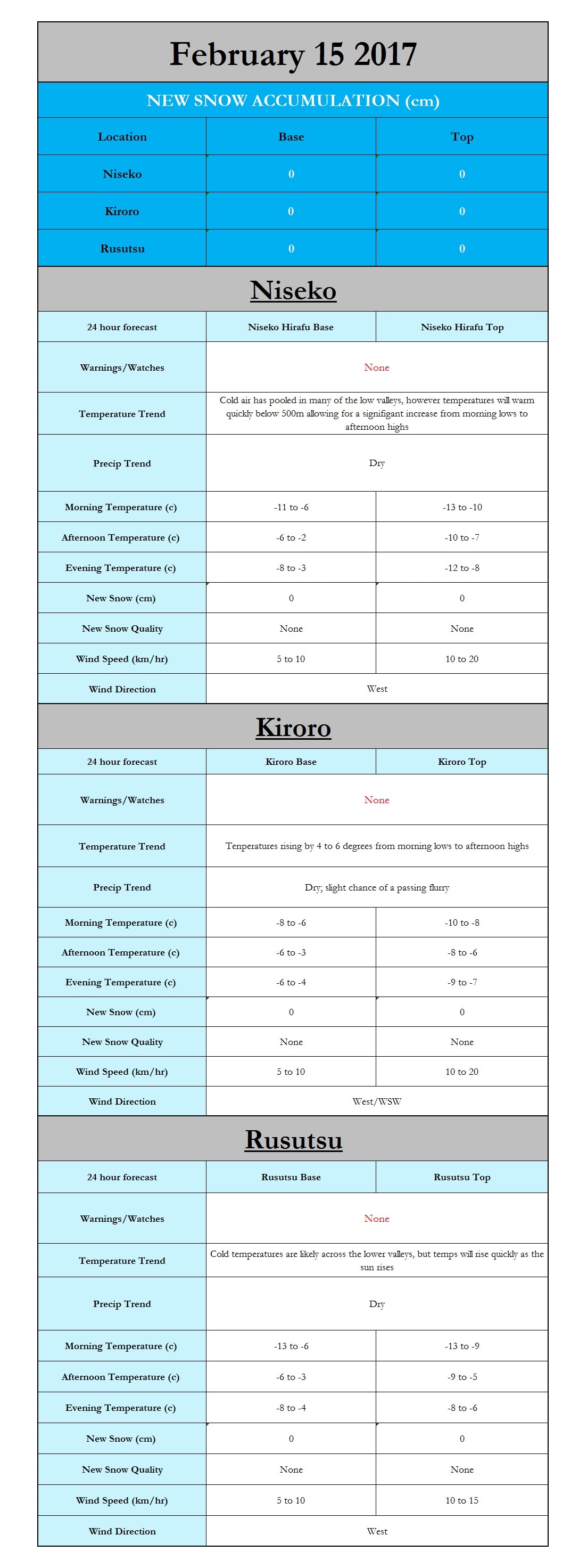
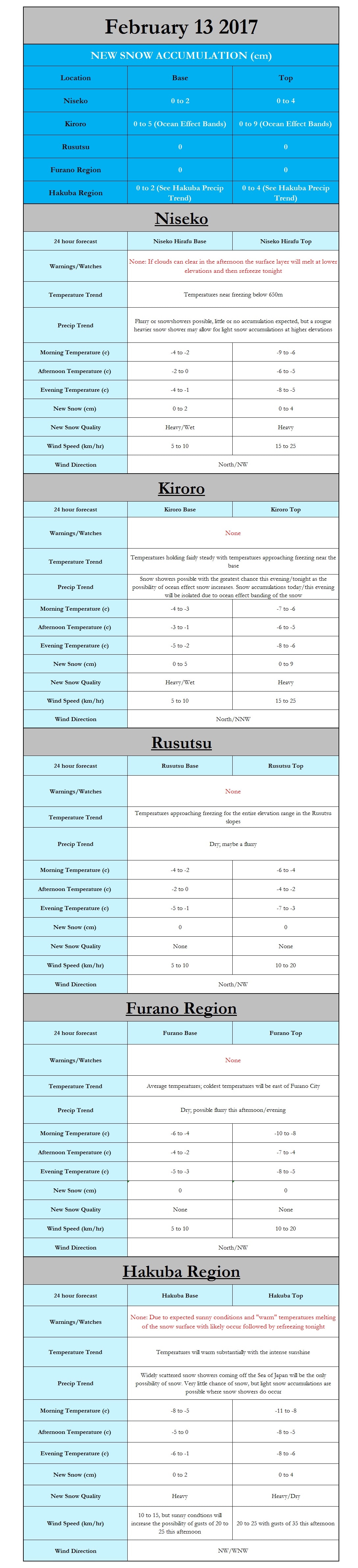
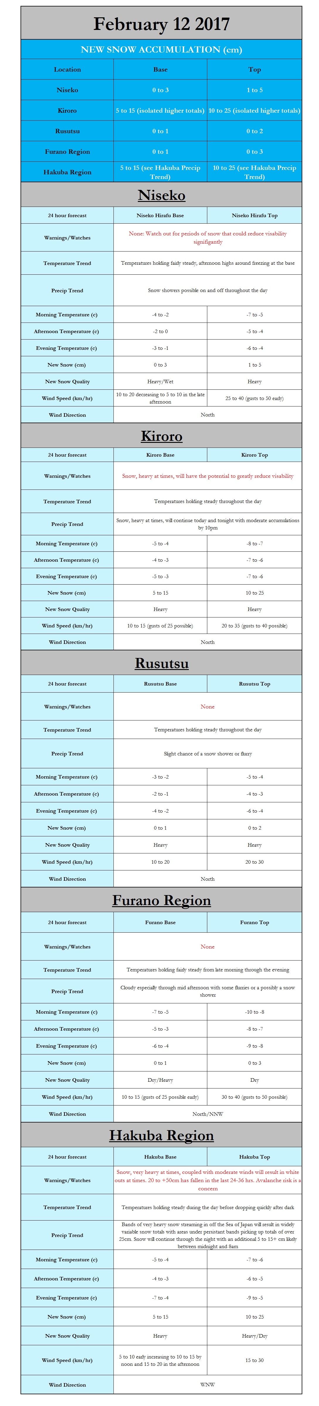
I hope everyone enjoyed their weekend and is ready to start another great day on the slopes across Hokkaido. Our next snowstorm is slowly edging its merry way towards Hokkaido, apparently unaware that it is not doing what was previously expected. That being said there is a shift in the forecast for both timing and snow totals. The onset of snow will likely be delayed by 4-6hrs with snow showers starting to impact Niseko, Kiroro, and Rusutsu in the mid to late afternoon. I am personally leaning towards the heaviest snow totals of these three occurring around Rusutsu, but a small shift in storm track or the onset of ocean effect/enhanced snow could greatly increase snow totals especially in Kiroro Japanskitours.com In-House Model 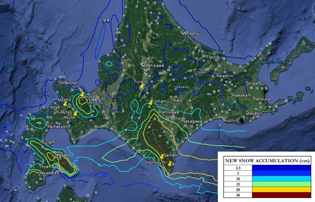  Hi all,  Hi all,  |
Author
Archives
March 2017
Categories |

 RSS Feed
|
|
Home - Trips - Cat Skiing - Ski Japan - About - Employment - Contact Us
Terms and Conditions - Privacy Policy - Specified Commercial Transaction Act Compliance - Japow Reality Check
Terms and Conditions - Privacy Policy - Specified Commercial Transaction Act Compliance - Japow Reality Check
Japan Ski Tours is an ANTA certified and licensed Japanese travel agency, registered in Tokyo, Japan
Travel Agency License No. 2-6983
Travel Agency License No. 2-6983
Japan Ski Tours, Japan Guides Group Copyright 2019 - 株式会社