|
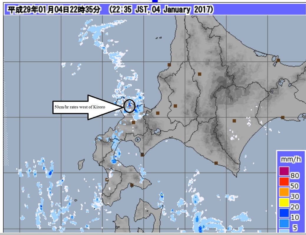
I feel confident in my earlier forecast of moderate to heavy snow overnight, especially in the Kiroro region. Akaigawa, which is sheltered from the most intense snow by the mountains, has recieved 12cm since noon with 5cm falling from 8-10pm. It appears that Kiroro is really getting hit hard currently with orographic lifting enhancing the snow rates in that region. Below is a link to the animated radar loop I compiled from JMA data (6pm to 11pm). Look at the intense snowfall in the mountains in the Kiroro region. This is so called orographic lifting, which essentially is the mountain forcing the air upward resulting in it dumping heavier snow. I will see you all in the morning with your indepth forecast for January 5th. https://www.youtube.com/watch?v=qvvKxLvBa-k (Youtube link to the below radar video) Paul Carlone SW Hokkaido radar loop of orographic lifted snow squalls (1/4/17 6-11pm JST)11pm 1/4/16: 50+ cm/hr snow rates west of Kiroro along highways 998/569
2 Comments
Leave a Reply. |
Author
Archives
March 2017
Categories |
|
|
Home - Trips - Cat Skiing - Ski Japan - About - Employment - Contact Us
Terms and Conditions - Privacy Policy - Specified Commercial Transaction Act Compliance - Japow Reality Check
Terms and Conditions - Privacy Policy - Specified Commercial Transaction Act Compliance - Japow Reality Check
Japan Ski Tours is an ANTA certified and licensed Japanese travel agency, registered in Tokyo, Japan
Travel Agency License No. 2-6983
Travel Agency License No. 2-6983
Japan Ski Tours, Japan Guides Group Copyright 2019 - 株式会社


 RSS Feed
