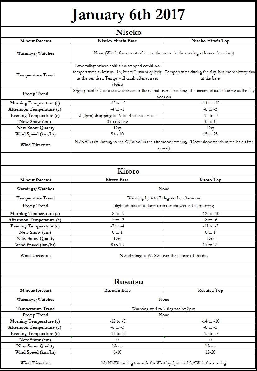
Outside of some scattered light snow showers or flurries the next 3 days look excellent. The next possibility of snow will roll in Monday (1/9/17) afternoon as a low pressure develops to the NW over the Sea of Okhotsk. Additionally a strong storm, off the eastern coast of Japan, moving N/NE will help to generate some precipitation across SE Hokkaido, but also in regions such as Hakuba on the mainland. Watch for a crust of ice on top of the snow this evening and tomorrow morning especially at lower elevations, as the sun will be out today with temperatures close enough to freezing at some lower elevations to melt the top layer of snow. |
Author
Archives
March 2017
Categories |
|
|
Home - Trips - Cat Skiing - Ski Japan - About - Employment - Contact Us
Terms and Conditions - Privacy Policy - Specified Commercial Transaction Act Compliance - Japow Reality Check
Terms and Conditions - Privacy Policy - Specified Commercial Transaction Act Compliance - Japow Reality Check
Japan Ski Tours is an ANTA certified and licensed Japanese travel agency, registered in Tokyo, Japan
Travel Agency License No. 2-6983
Travel Agency License No. 2-6983
Japan Ski Tours, Japan Guides Group Copyright 2019 - 株式会社


 RSS Feed
