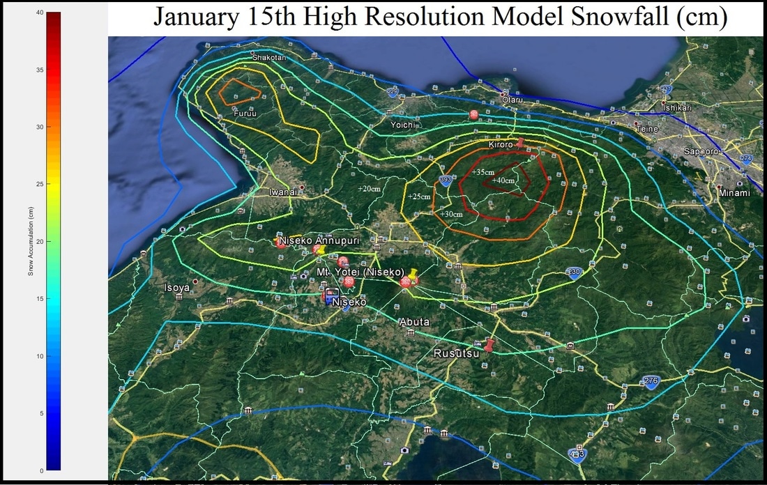
A low pressure system is spinning off the SE coast of Hokkaido currently, bringing with it snow potentially quite heavy. Down to the south towards Mori and Onuma they have picked up in excess of 20cm with much of it falling it this evening. The high resolution models are putting out some pretty impressive numbers and while I think it is overdoing the totals, I would not be surprised to see some decent totals. I will have a full forecast in the morning, but I will leave you with this pretty crazy snowfall map from our in-house high resolution model (yes it is saying +40cm).
0 Comments
Leave a Reply. |
Author
Archives
March 2017
Categories |
|
|
Home - Trips - Cat Skiing - Ski Japan - About - Employment - Contact Us
Terms and Conditions - Privacy Policy - Specified Commercial Transaction Act Compliance - Japow Reality Check
Terms and Conditions - Privacy Policy - Specified Commercial Transaction Act Compliance - Japow Reality Check
Japan Ski Tours is an ANTA certified and licensed Japanese travel agency, registered in Tokyo, Japan
Travel Agency License No. 2-6983
Travel Agency License No. 2-6983
Japan Ski Tours, Japan Guides Group Copyright 2019 - 株式会社


 RSS Feed
